
Walk the Prairieville Street Directory
A Prairieville street directory search should preserve the difference between ownership and occupancy. Ascension Parish property records name the assessed owner and connect that person or entity to a parcel. The Louisiana Voter Portal may show registered voters tied to one entered address, but it is neither a full household roll nor proof that every listed voter remains there. A deed records an interest or transaction. An old reverse directory may place an occupant at that address in a specific publication year. Used together, those sources can answer a street question without claiming more than the records support.
- Enter the address in the Ascension Parish Assessor Beacon search. Save the owner, parcel number, legal description, subdivision, and physical address.
- Open the same parcel in Ascension Parish GIS. Click nearby polygons to move along the street and record each situs address.
- Test one address in the Louisiana Voter Portal address search. Treat its names as voter evidence, not a complete list of occupants.
- Search each owner's purchase through the Clerk's grantor and grantee index. Match the legal description before accepting a name as part of the chain.
- Ask the Ascension Parish Library for reverse or criss-cross books, which arrange entries by address, when the question concerns an earlier household.
The useful flow is address to parcel, parcel to owner, owner to deed, then address to voter or directory evidence. This method also exposes conflicts. A mailing city outside Prairieville does not move the parcel, and a voter result does not transfer title.
Prairieville Parcel Search Fields
The assessor advertises searches by property address, owner name, parcel number, and subdivision. Its live form was not fully exposed during research, so the verified GIS fields are the safe technical backstop. Search spelling can matter. Preserve street direction and suffix variants, and try the indexed owner form if a natural name order fails.
| Search control | Kind | Required | Prairieville use |
|---|---|---|---|
| Address | Text | Not verified | Search a street or situs address with direction and suffix variants. |
| Owner name | Text | Not verified | Try surname-first, all-capital, trust, estate, and entity forms. |
| Parcel number | Text | Not verified | Use the stable parcel key; no public format was confirmed. |
| Subdivision | Text or list | Not verified | Narrow repeated street names and grouped lots. |
| Map browse | Map control | No | Select a parcel polygon and inspect nearby layers. |
| Advanced search | Mode | No | Advertised by the assessor; confirm current fields in the browser. |
Save both the result and its date. Assessment data can change, and the parcel service warns that mapped lines may be based on several sources. A GIS polygon is a research aid, not a survey.
The assessor's property-search field guide shows the public route used by the Prairieville street directory.
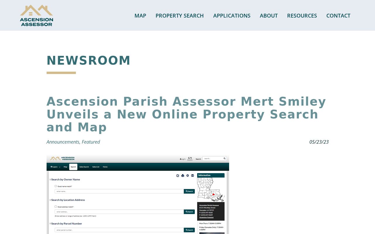
The captured page confirms that address, owner, parcel, subdivision, and map routes belong to the official assessor workflow.
Prairieville Situs and Mailing Fields
Ascension's GIS keeps owner mailing fields apart from the parcel's physical fields. This is one of the most useful Prairieville details. Situs address means the physical location assigned to the parcel. Owner mailing data shows where the tax or assessment notice goes. The two may differ because of a post office box, an agent, a trust, an estate, or ownership from another place.
- Parcel
- A mapped unit of land linked to an assessment and legal description.
- Situs address
- The physical address of the parcel, distinct from the owner's mailing address.
- Plat
- A recorded map that identifies lots, blocks, streets, and subdivision boundaries.
- Criss-cross directory
- A directory arranged by street and house number instead of only by surname.
Never turn a mailing address into a claim that the owner lives there. Keep `Owner_Address` and the physical address fields in separate columns. Then use deeds, voter records, or a dated directory to test the relationship.
The official parcel-address field service exposes the source structure behind this distinction.
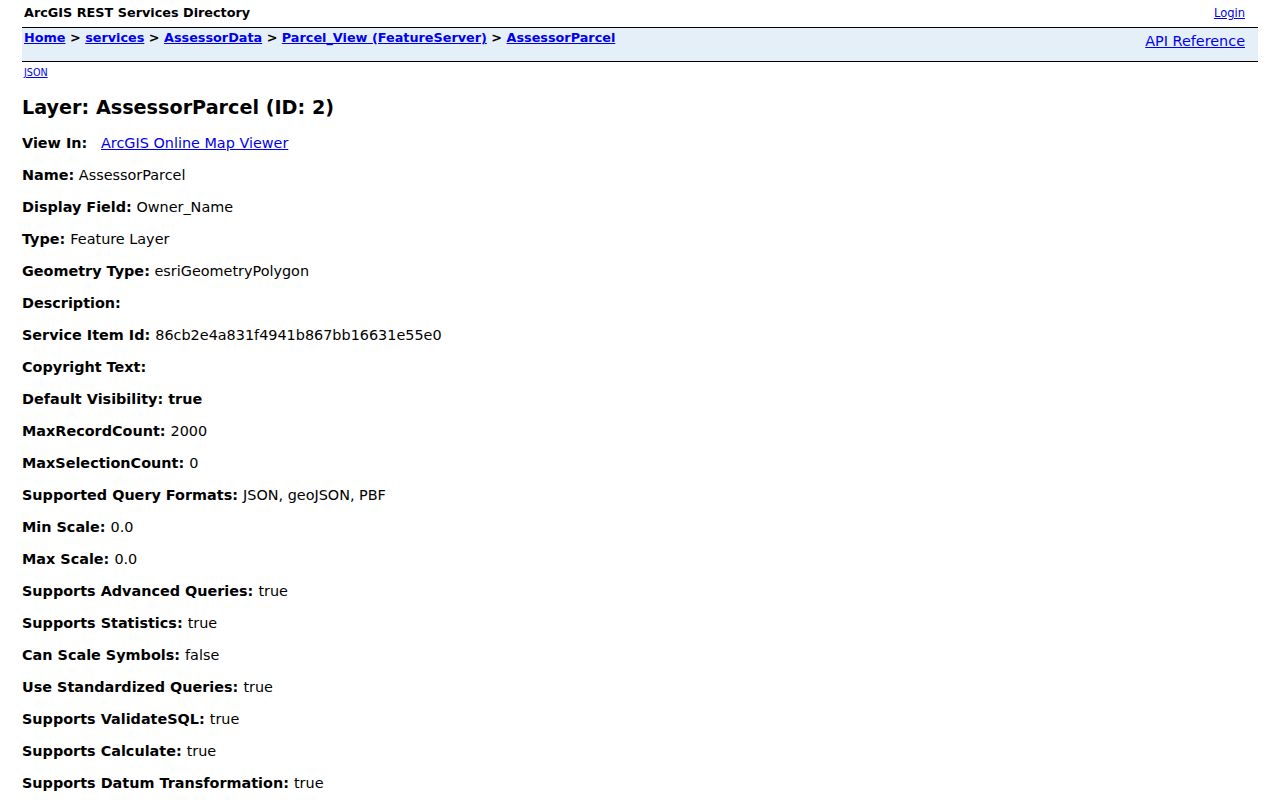
The screenshot helps show why a street list must retain both physical and mailing columns before drawing any conclusion.
Browse Prairieville Streets in GIS
The parish map can be walked from one known parcel to the next. Search or pan to an address point, click its polygon, and record the parcel key. Then select the directly touching lots. Useful layers include address points, parcels, lots, subdivisions, zoning, flood and LOMA data, council districts, traffic districts, sewer districts, and code-enforcement cases. These layers describe the place around an address; they do not identify every person there.
For a whole segment, narrow by street, subdivision, map extent, ZIP, or geometry. The ArcGIS service has a 2,000-record maximum, so a parish-wide pull is too broad. A map extent or short street segment produces a cleaner, reviewable set. The result becomes a practical by-street ledger when each row keeps the parcel number, situs fields, owner fields, lot, subdivision, legal description, and source date.
The OpenGov GIS layer service displays the address, lot, zoning, flood, district, and code layers available for street research.
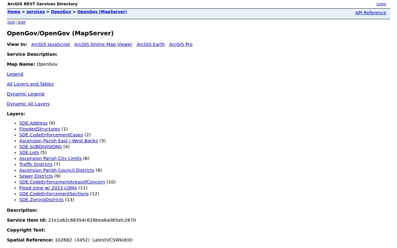
This view connects a house number to its mapped context while keeping ownership and occupancy as separate questions.
Prairieville Records Indexed by Address
Several Ascension Parish systems accept an address or can be joined to one through a parcel, owner name, or legal description. Each answers a narrow question. The table keeps access channels visible when a public form is missing or an account blocks a remote search.
| Address source | Custodian | Evidence returned | Ways to reach it |
|---|---|---|---|
| Assessment roll | Ascension Parish Assessor | Owner, mailing address, parcel, subdivision, assessment details | Beacon search, map, Prairieville branch, phone |
| GIS parcel map | Ascension Parish GIS | Physical address, polygons, lots, zoning, flood and district layers | Public viewer, REST service, GIS office |
| Recorded deeds and maps | Ascension Parish Clerk of Court | Grantor, grantee, instrument, book/page, legal description, image status | eClerksLA/eVault account, public computers, phone, office copy |
| Voter address result | Louisiana Secretary of State | Public registration and election-district data for an entered address | Public portal, Registrar of Voters, formal list request |
| Code and permit routes | Parish Code Enforcement and Planning | Complaint, inspection, notice, permit or planning leads tied to an address | Phone, email, complaint route, public-records request |
| Historical directories | Ascension Parish Library and State Library | Dated occupant, phone, name, and address clues where a volume exists | Reference desk, print, microfilm, licensed databases |
The parcel number and legal description form the strongest bridge from map to deed. The street name joins address-based voter and library searches. When a form does not expose all fields online, call the custodian or use Louisiana's public-records request route instead of assuming the source does not exist.
Follow Prairieville Deeds by Street
For each parcel, search the current owner as a grantee, meaning the buyer or recipient named in the recorded act. Open the purchase record, if access permits, and capture the grantor, the seller or transferor. The next backward search uses that grantor as an earlier grantee. Always match the legal description, since two people can share a name and one entity can own several properties.
The archived Clerk agreement gives land index and image coverage from July 1970 forward, mortgage indexing from 1914, and map records from 1807. Those dates are not equal. An old map or index can exist even when no deed image is available online. FamilySearch's Ascension conveyance index from 1770 through 1957 offers an older lead, but the Clerk copy remains the official record.
The Ascension Parish Recording Department explains the recorded deed and mortgage route used after the parcel search.
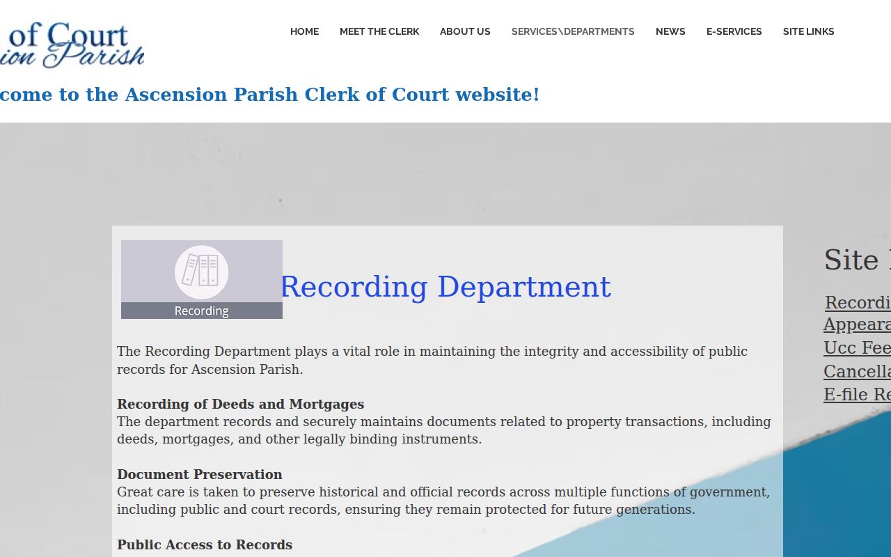
The captured page marks the correct custodian when an online image is gated, missing, or not yet indexed.
Current remote access has moved toward eClerksLA and account workflows. Both Clerk offices have public-access computers, and recording copies can be requested by phone. The Donaldsonville office has a roof-damage closure notice, so verify access and favor the Gonzales counter before an in-person visit.
Check a Prairieville Voter Address
The public voter portal offers a separate address route. Enter the address and ZIP as the form requests, then read only the public registration and district information returned. The portal deliberately does not expose Social Security numbers, full birth dates, email addresses, or a mother's maiden name. Protected addresses may also be withheld.
The official voter address lookup is a useful Prairieville street directory cross-check.
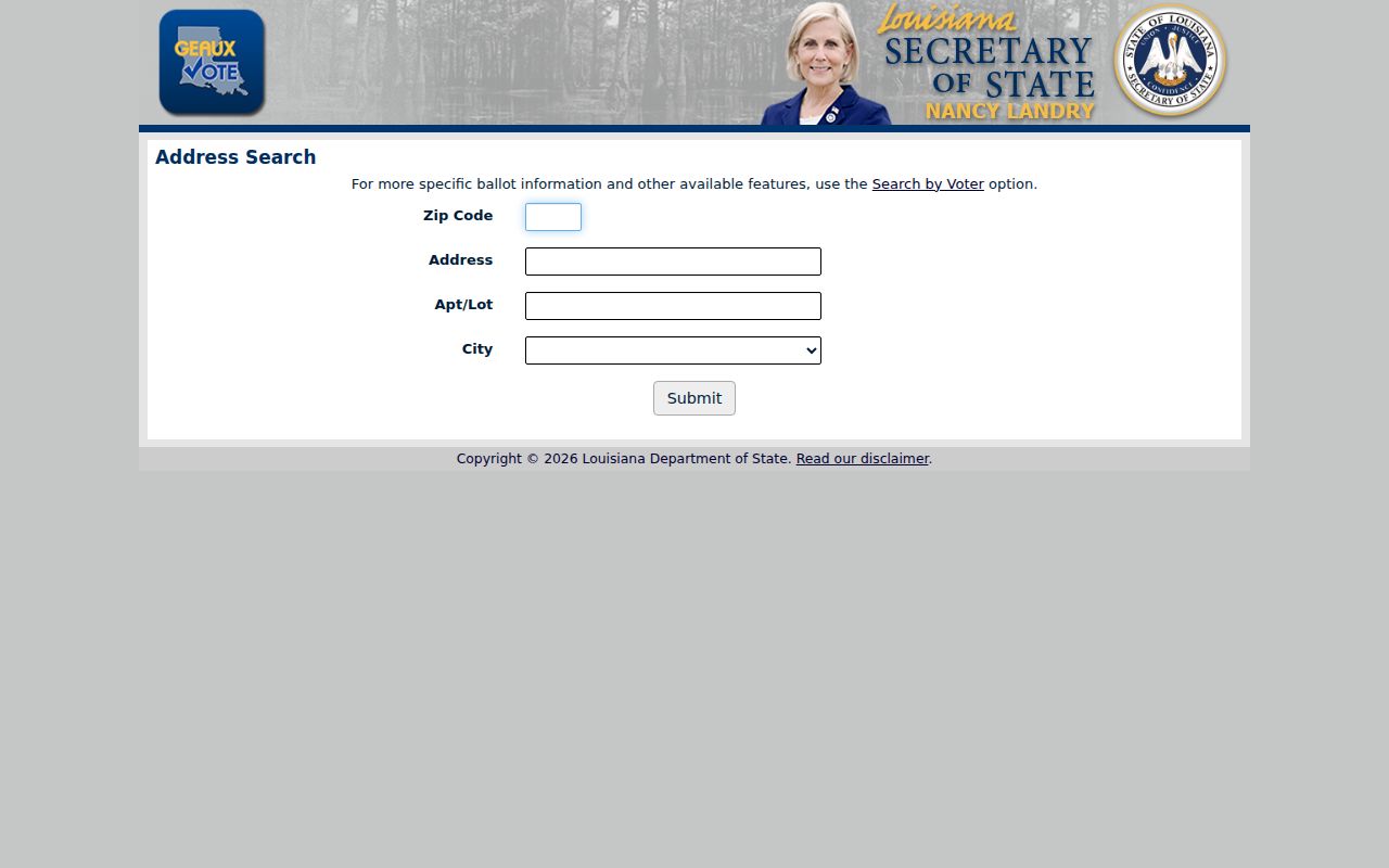
The form can support one lawful address check, but it does not create an unrestricted roll of everyone on a street.
A formal voter-list request is a different access channel and has its own official process, fields, prices, and protected-data rules. The Ascension Registrar of Voters can explain the parish route. A missing portal result may mean no registration, an old entry, a protected record, or a formatting mismatch. It does not prove a home is vacant.
Prairieville Code Clues by Address
Ascension Parish Code Enforcement requires a property address for a complaint. Its page says an inspection is typically made within 24 hours and a notice follows when observed conditions violate the adopted code. Anonymous complaints are not accepted. An inspector observes from the public right-of-way, and the office does not settle private boundary disputes or deed restrictions.
No complete public case-search form with every field and status was found. Use the official code-enforcement route, the parish phone channel, or a public-records request for an address-specific question.

The screenshot documents the actual fallback route without promising a searchable permit or code database that the parish does not publish.
A complaint is only a lead. It does not show that a named person caused the condition, and it cannot replace a deed, plat, survey, or inspection file. Planning and Development handles permit, zoning, and floodplain routes; permit questions may also go to the address published by the parish.
Bridge Old Prairieville Addresses
Prairieville is an unincorporated census-designated place, not a city with its own clerk or assessor. Older records may use a rural route, a subdivision and lot, a legal description, or a nearby Gonzales or Donaldsonville heading instead of the current Prairieville label. No official street-renumbering year was verified, so a failed exact-address search should not be filled with a guessed date.
Start with the current parcel and write down the legal description, map book, lot, block, and subdivision. Search those stable land terms in the Clerk's maps and deeds. Then test old street spellings and post-office labels at the library. The Galvez branch is in Prairieville, while the Gonzales branch is the main genealogy and local-history hub.
For the historical shelf itself, including how to read an address-arranged volume, use the Prairieville city directory collections. Modern address-keyed searching remains the focus of the street directory.
Prairieville Street Directory Limits
No Prairieville street directory can name every renter, child, visitor, or household member. The property roll records an assessed owner. A deed records a legal act. Voter data omits unregistered people and protected fields. Driver address data is closed under federal law, and utility or delivery accounts are not a public resident roll. Address Confidentiality Program participants may use substitute addresses in state and local services.
Dates matter. An owner can sell, a voter can move, and a new instrument may have an official number before web indexing is complete. Keep the retrieval date and confirm important findings with the custodian. If the goal shifts to verifying one named person rather than examining a street, the Prairieville resident lookup uses a different evidence chain.
Lawful use. Use Prairieville address records only for lawful personal research. Never use them to stalk, harass, threaten, or harm another person.